Tropical Storm Bertha Threatens Northern Gulf Coast with Surge, Rain, and Rip Currents
Bertha is the second named storm of the 2026 Atlantic hurricane season
UPDATE from the 11:00 AM NHC Advisory: Tropical Storm Bertha now has maximum sustained winds of 60 mph. T.S. Bertha is not traveling NNW at 3 mph. That's a drop from the 5 mph reported this morning.
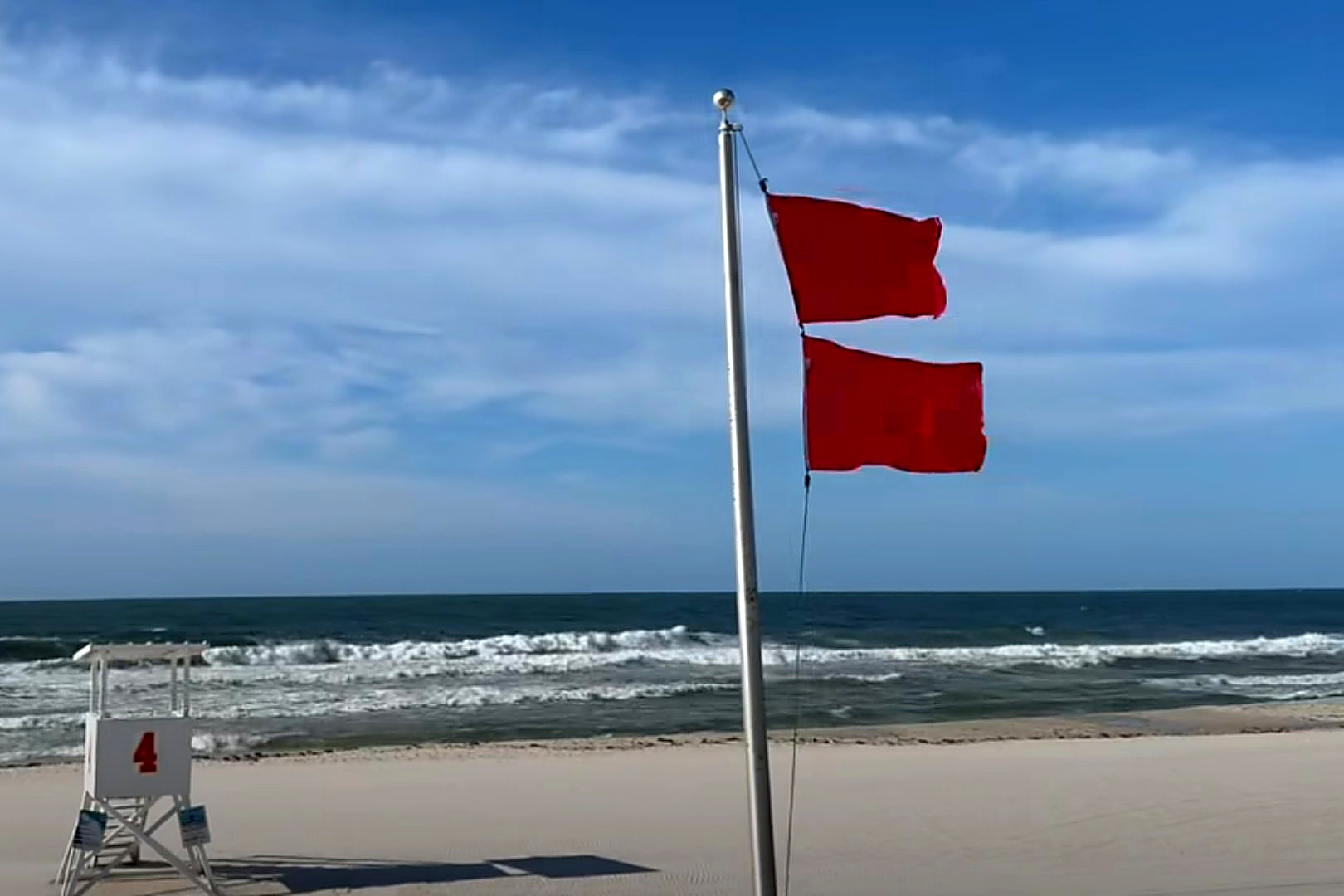
Also, Orange Beach Surf Rescue is now flying Double Red Flags, meaning the Gulf is closed to swimmers. According to forecasters, T.S. Bertha is not expected to strengthen any further.
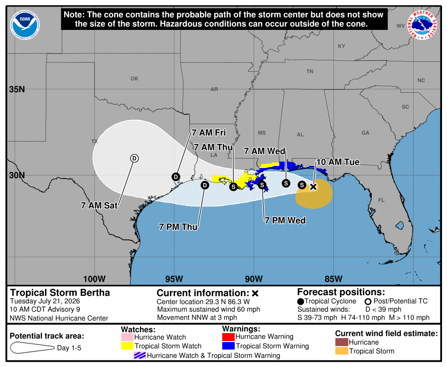
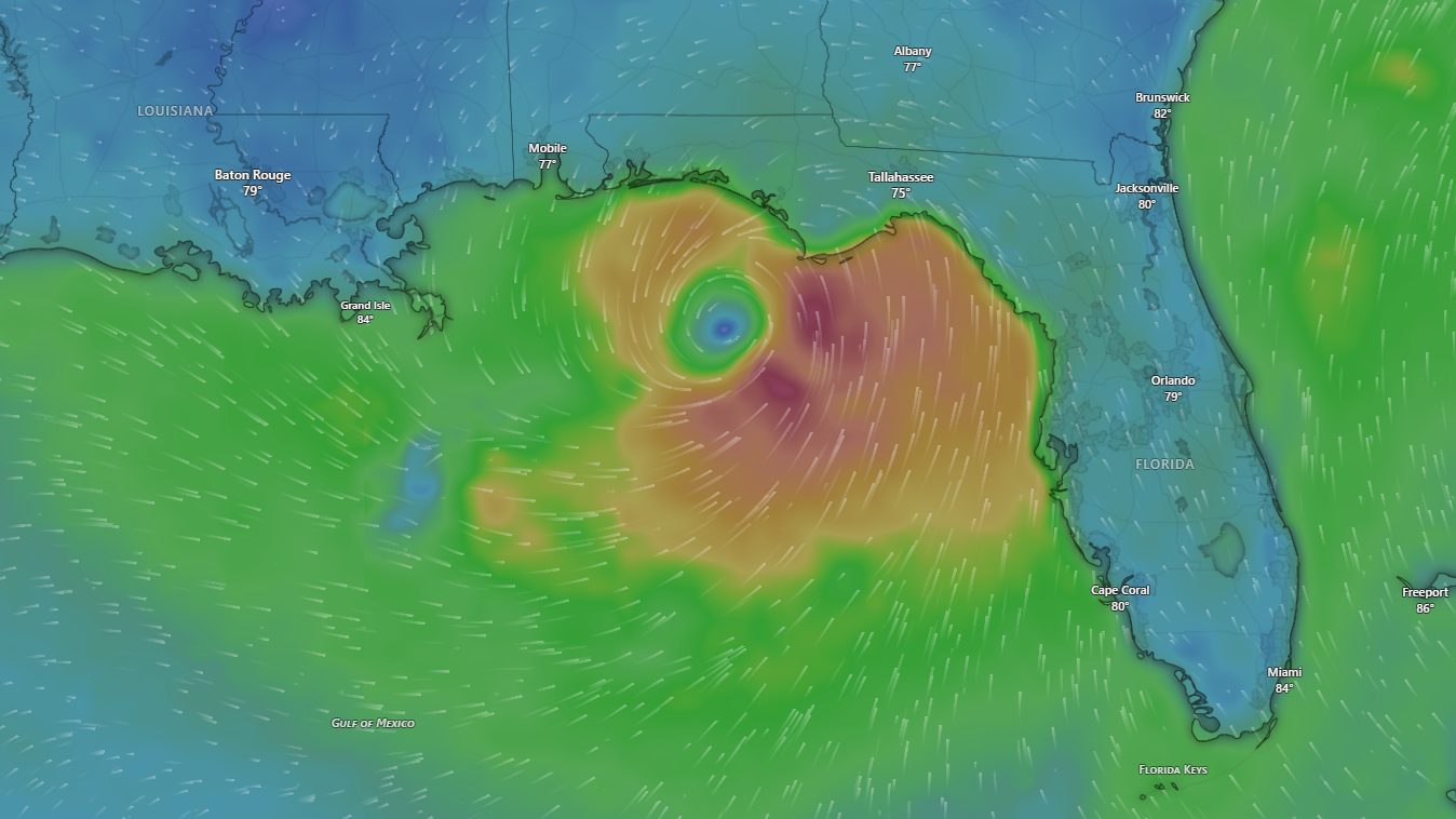
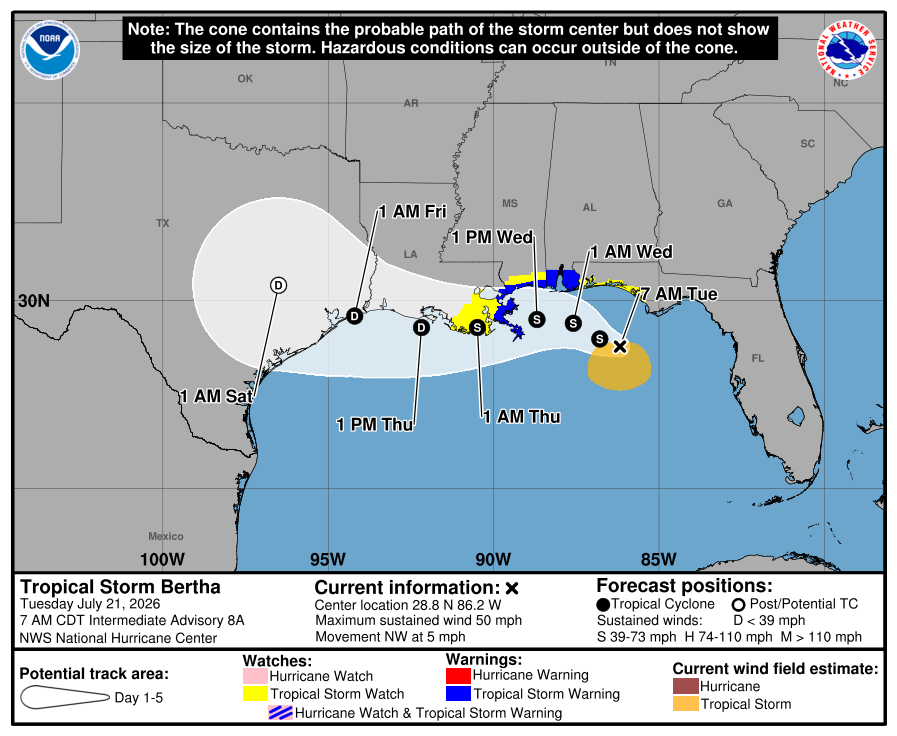
Orange Beach, Ala. — (OBA) — Tropical Storm Bertha was about 175 miles southeast of Mobile, Alabama, as of 7 a.m. CDT on Tuesday, July 21, 2026. The National Hurricane Center in Miami issued Intermediate Advisory 8A at that time, placing the storm's center near latitude 28.8 North, longitude 86.2 West. Maximum sustained winds are 50 mph, and the storm is moving northwest at 5 mph. NOAA Hurricane Hunter aircraft were investigating Bertha at the time of the 7:00 AM advisory.
As of Tuesday, July 21, 2026, a Tropical Storm Warning was in effect from the Alabama-Florida border westward to the Jefferson-Plaquemines Parish border in Louisiana. A Storm Surge Watch was also in effect from the Alabama-Florida border to the mouth of the Mississippi River. A Tropical Storm Watch covered the Bay-Gulf County line in Florida westward to the Florida-Alabama border, as well as areas west of the Jefferson-Plaquemines Parish border to Morgan City, Louisiana.
The National Hurricane Center said Bertha is expected to move slowly northwestward to west-northwestward through Tuesday, then turn west by midweek. The storm is forecast to move near or along the northern Gulf Coast over the next several days before eventually tracking toward Texas.
Some slight strengthening is possible late Tuesday, according to NWS National Hurricane Center forecasters. Gradual weakening is then expected through the middle of the week. Tropical-storm-force winds extend up to 80 miles from the center.
Storm surge remains a serious concern for coastal communities, including Gulf Shores, Orange Beach, and Perdido Key. The NHC said that surge-related water could reach two to four feet above ground along the coast from the mouth of the Mississippi River to the Alabama-Florida border. Areas along the immediate coast face the deepest water, and surge levels can vary greatly over short distances, depending on the timing of the surge and the tidal cycle.
Rainfall from Bertha is expected to total two to four inches across much of the central Gulf Coast, with isolated amounts of up to six inches possible through Thursday. Southern Alabama and Mississippi are included in the rainfall threat. Flash flooding is possible, especially in urban areas, according to the NHC advisory.
Purple and Single Red Flags are currently flying on our beaches this morning. Beachgoers are encouraged to check conditions before entering the Gulf, as conditions can quickly change. Single Red Flags represent High Hazard with High Surf and Strong Currents. Purple Flags are for the presence of Jellyfish.
Swells from Bertha are already affecting parts of Florida's Gulf Coast and are expected to move westward through the week. The NHC warned that these swells are likely to produce life-threatening surf and rip current conditions along the northern Gulf Coast. Beachgoers in Gulf Shores, Orange Beach, and along the Alabama coast are urged to check flag conditions before entering the water.
Residents and visitors are urged to monitor local National Weather Service products from the NWS Mobile office for updates specific to their area. The NHC said additional watches or warnings may be issued as the storm progresses. Officials recommend that those in flood-prone areas stay alert and follow guidance from local emergency management.
Share this article w/ Friends...