Updated Baldwin Beach Express II Plan Aims To Ease Traffic
County Commission Approves Updated Access Management Plan for 25 Mile Corridor Between I-10 and I-65
Baldwin County leaders have approved a key update to a major north–south highway project that they say will shape traffic and growth for years to come. The Baldwin County Commission has adopted a new access management plan for the Baldwin Beach Express II, a planned multi-lane divided corridor between Interstate 10 and Interstate 65. County officials describe the plan as a major step toward safer, more efficient travel along the future route. They also say it will help protect the character of the roadway while giving nearby property owners reasonable access.
The action came during the commission’s meeting on January 20, 2026, when members voted to adopt the updated Baldwin Beach Express II Access Management Plan. It follows an earlier decision by the commission to authorize right-of-way acquisition along the southern portion of the corridor near Interstate 10.
Related Article: Gulf Shores Pedestrian Bridge Project Reaches New Milestones
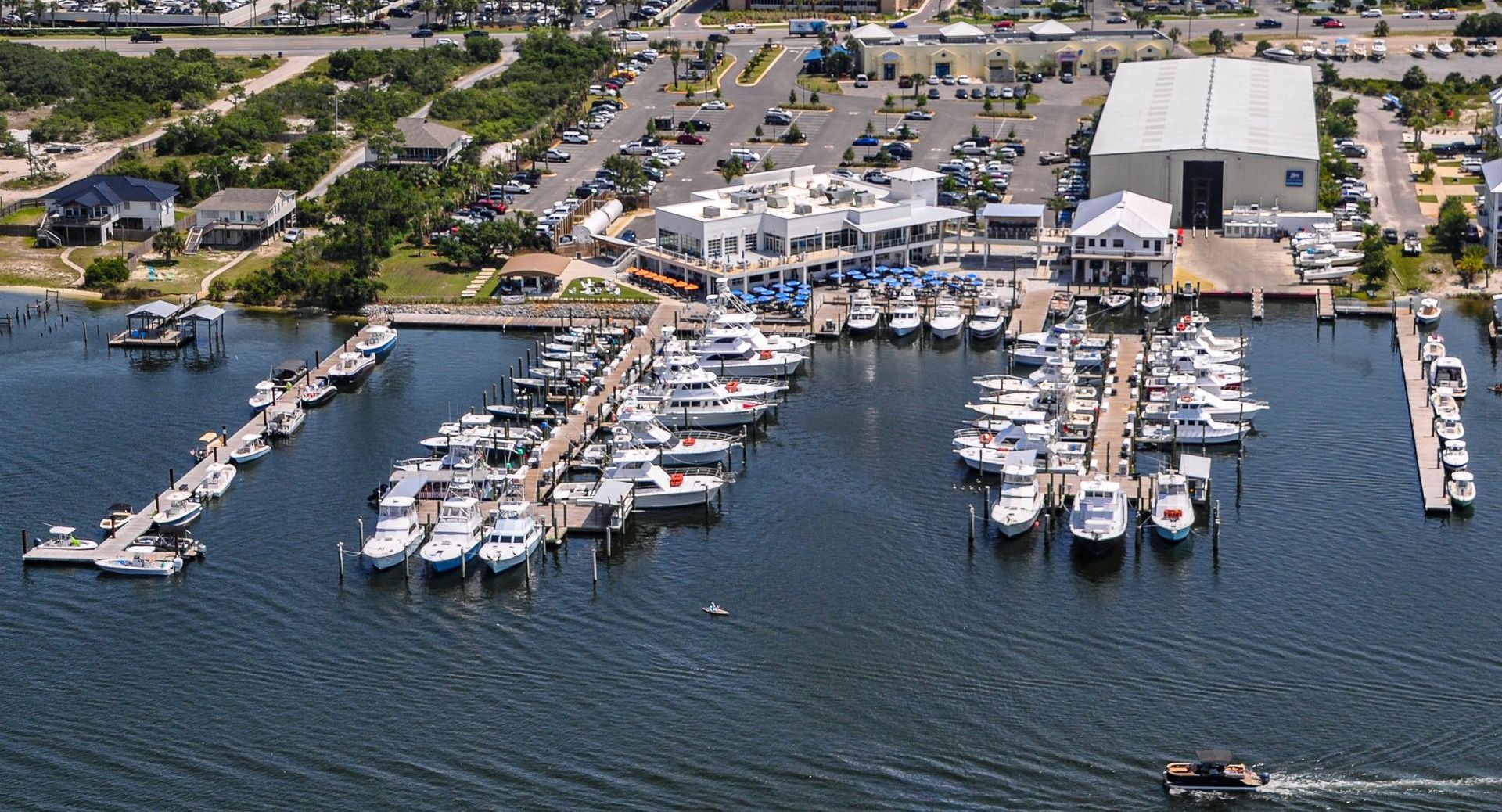
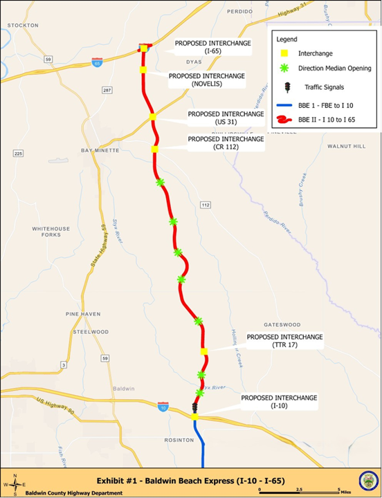
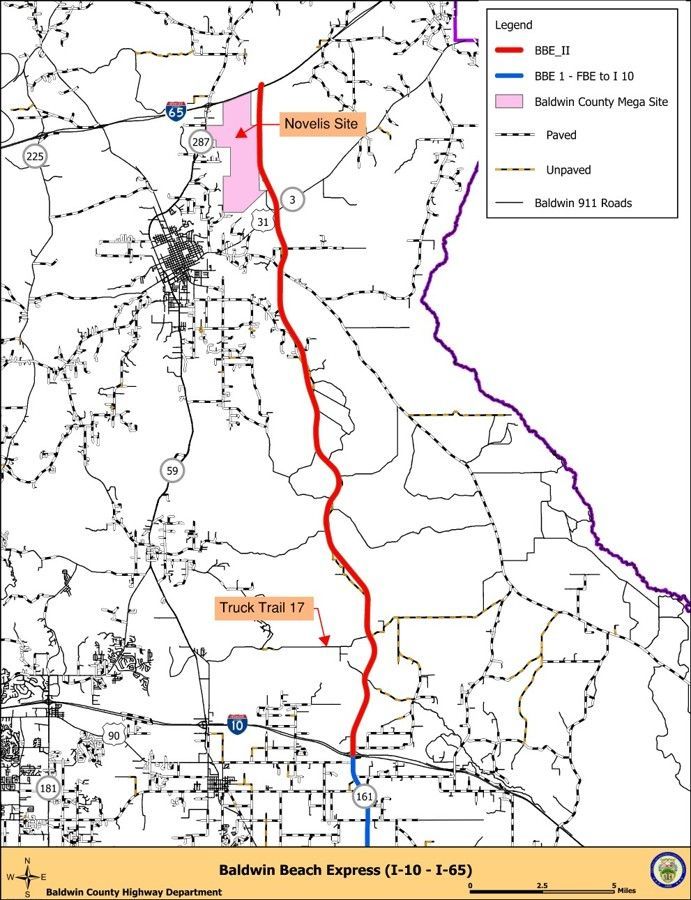
The Baldwin Beach Express II corridor is planned as a 25-mile, multi-lane, divided highway connecting Interstate 10 to Interstate 65. The project is designed to link three U.S. routes, ease regional traffic congestion, support emergency evacuation routes, and advance the county’s long-term infrastructure goals.
Baldwin County Engineer Frank Lundy called the vote a milestone for a fast-growing area. “Today was a very historical moment for Baldwin County,” Lundy said in a statement to the commission. “This project will allow better access for property owners and better traffic flow.” He added that the plan is “very important for planning and growth in Baldwin County as we continue to grow while preserving the character of the roadway.” “With the adoption of this new plan, we avoid plugging up intersections and public safety concerns,” Lundy said.
Under the updated plan, access along Baldwin Beach Express II is intended to be safer and more consistent while preserving the free flow of traffic on the main lanes. County officials say the design also aims to provide reasonable access for property owners along the corridor.
Most major crossroads on the highway use grade-separated interchanges, allowing vehicles to enter and exit without slowing traffic on the main roadway. Smaller intersections and driveways that connect directly to the corridor will be limited to right-in and right-out turns, meaning drivers can turn into or out of a property but cannot cut across oncoming lanes.
The only traffic signal planned along the corridor will be located at County Road 68, just north of Interstate 10. Directional median openings at selected locations will allow drivers to make safe U-turns, officials say, helping reduce crash risk while keeping traffic moving smoothly.
Planned grade-separated interchanges include locations at Interstate 10, Truck Trail 17, County Road 112, U.S. Highway 31, Novelis, and Interstate 65. County leaders say these points are critical to maintaining continuous north–south traffic flow along the route.
The prior access management plan for the project was drafted nearly a decade ago under older roadway standards. Officials say it did not fully reflect existing roads or the pace of future growth in Baldwin County. The updated plan now aligns with current design practices, provides better access to nearby properties, and supports safer, more efficient traffic movement as the county continues to expand.
Members of the public and media seeking more information can submit a request through the Baldwin County media request form on the county’s website. The form is available through the county administration’s media request page.
Share this article w/ Friends...