
Sunday Morning Tropical Update
National Weather Service Mobile • June 7, 2020
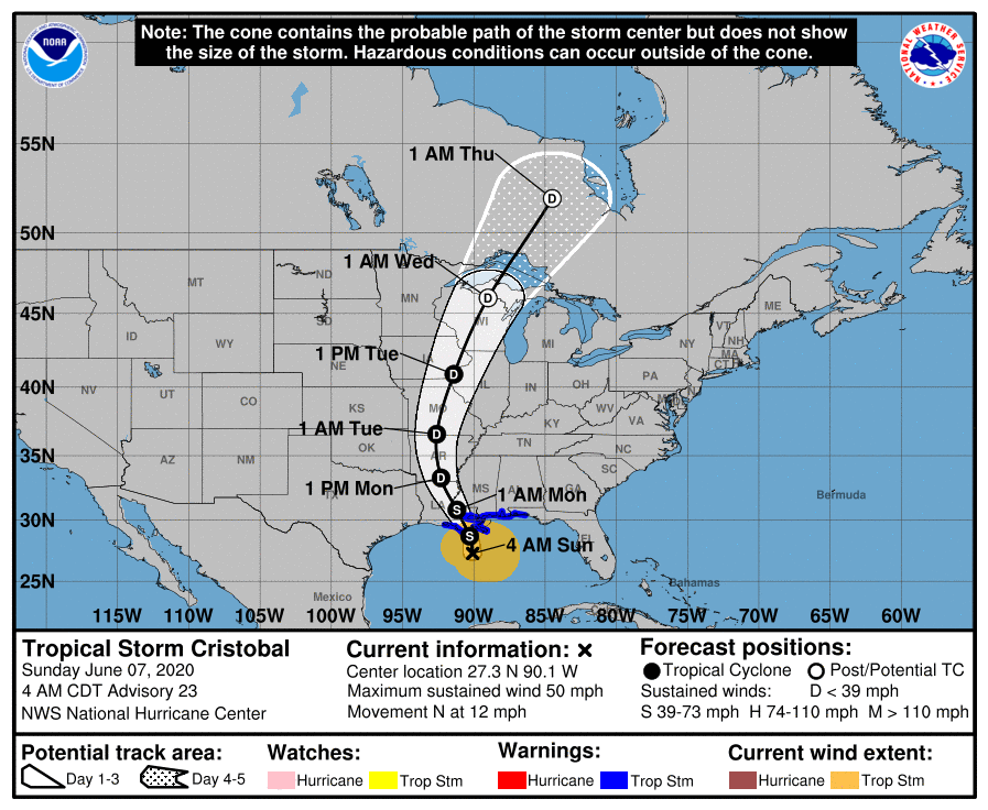
At 4 am TS Cristobal is just offshore of Louisiana
(OBA®) -- Sunday Morning Update on Tropiclal Storm Cristobal.
Here in Orange Beach we have seen 0.3 inches of rain since midnight. OBA Weather Page
From the National Weather Service in Mobile...
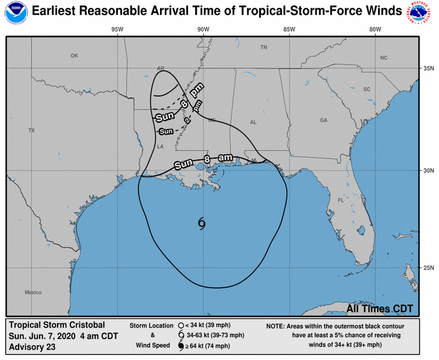
🌀4am #Cristobal Update [06/07]: Cristobal is still forecast to make landfall in southeast Louisiana this evening. A Tropical Storm WARNING remains in effect for Stone and George Counties in southeast Mississippi, extreme southwest Alabama, and the northwest Florida coast. Conditions will continue to deteriorate along the coast this morning with the strongest winds this afternoon.
⚠️ KEY CHANGES: The Flash Flood Watch now includes Choctaw and Clarke Counties in Alabama. The flooding rain threat continues to increase across parts of southeast Mississippi. Coastal Flood Advisory and High Surf Warning run through Tuesday.
⚠️ IMPACTS: Here's what we know...
☔RAIN/INLAND FLOODING: The flooding rain threat continues to increase across parts of southeast Mississippi. Potential for MAJOR to EXTREME flooding across southeast Mississippi. Heavy rain and flooding are likely through Monday morning, especially southeast Mississippi where 4-8" of rain is forecast (isolated totals up to 10 inches possible). Further east, we could see 4-6" in coastal Alabama and 2-3" of rain across northwest Florida. FLASH FLOOD WATCH was expanded further into southwest Alabama. The WATCH continues tor all of southeast Mississippi, parts of southwest Alabama, and northwest Florida.
🌊BEACHES: HIGH risk of rip currents will persist through early next week. High Surf Warning for dangerous 9-12 foot breakers extended through Monday night.
🌊COASTAL FLOODING: 3 feet inundation in northern Mobile Bay, 2-3 feet inundation across coastal Alabama, and 1-3 feet inundation across northwest Florida today and Monday at the time of high tide (10am-2pm). The highest inundation will occur across coastal Alabama on Monday morning. We could see coastal flood issues linger into Tuesday morning. Some of the locations of greatest risk are the west end of Dauphin Island, Causeway over Mobile Bay, immediate shores of rivers that feed into Mobile Bay, low-lying coastal roads in Bayou La Batre and Coden, and the Ft Pickens area. There will be some flooding likely on the Causeway today with more significant flooding on Monday.
🌬️WIND: No major changes. Strongest winds are expected this afternoon. Tropical storm-force winds will most likely arrive early this morning along the coast and late this morning across southeast Mississippi. Winds start to diminish late tonight, but gusty southerly winds will continue along the coast.
🌪️TORNADO: No major changes. Conditions are becoming increasingly favorable for a few tornadoes mainly this afternoon and tonight. The greatest potential for a few tornadoes remains across southeast Mississippi, extreme southwest Alabama, and northwest Florida. Make sure you have a plan and have multiple ways to receive warnings, especially with the possibility of tornadoes while you sleep.
💻LOCAL TROPICAL INFO: www.weather.gov/srh/tropical?office=mob (bookmark it!)
---------------
👉IN-DEPTH DISCUSSION:
The convection near the center of Cristobal remains limited, although it has become a little better organized during the past several hours. In addition, aircraft and scatterometer data show that the radius of maximum winds remains at or above 90 n mi.
The initial motion is north at 10 kt between a deep-layer ridge to Cristobal's east and a mid- to upper-level trough over the western Gulf of Mexico. This general motion should continue for 12-18 hours, followed by a turn toward the north-northwest due to a mid-latitude ridge passing north of the cyclone. After 36 hours, a turn toward the north and north-northeast is expected as Cristobal or its remnants encounter the mid-latitude westerlies. There are no important changes to either the track guidance or the forecast track since the last advisory.
The broad nature of the cyclone and significant dry air entrainment is likely to prevent intensification before landfall, and the new intensity forecast holds the intensity constant at 45 kt until that time. Cristobal remains a broad and asymmetric storm. Therefore, one should not focus on the exact forecast track, as the associated winds, storm surge, and rainfall will extend well away the center.
Share this article w/ Friends...

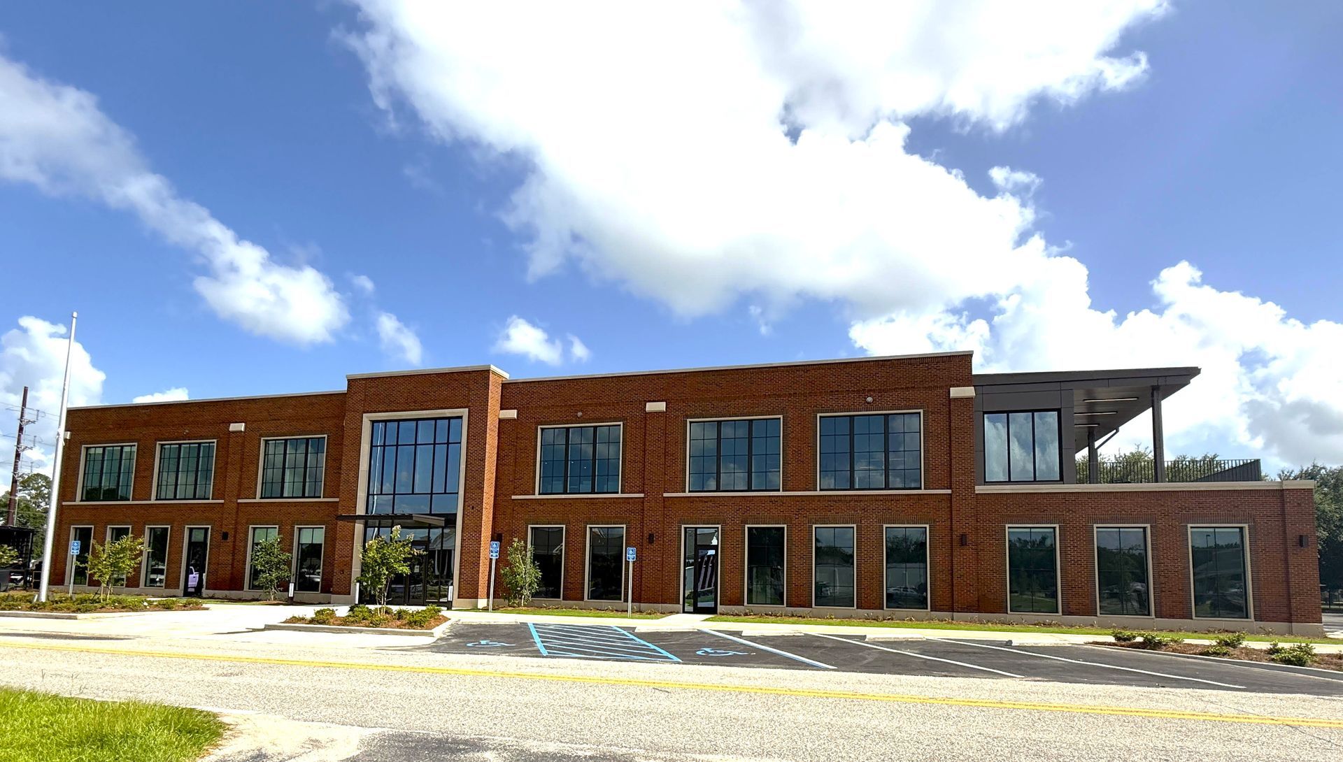
Foley, Ala. — (OBA) — Foley has opened a new campus for city departments serving its growing population. The 14-acre Foley Public Works Campus consolidates several operations in one location. The five-building facility houses the city’s Public Works, Engineering, Sanitation and Street departments. City officials, empl

Gulf Shores, Ala. — (OBA) — The Gulf Coast Chamber's Island Spirit Award committee, presented by Bluewater Exteriors, announced that Rocio Miranda-Garcia of De Soto's Seafood Kitchen is the June 2026 winner. Miranda-Garcia was honored for her outstanding service and dedication to her customers and community. The award

Foley, Ala. — (OBA) — Baldwin County has opened a free cooling center in Foley in response to dangerous heat affecting the area. The center is at St. Paul's Episcopal Church Parish Hall, 506 N. Pine St., Foley. It will be open Monday and Tuesday from 10 a.m. to 8 p.m. Pets are welcome, provided they remain under their

Orange Beach, Ala. — (OBA) — Whether you’re a local hunting for something fresh or a visitor eager to make the most of your beach holiday, you’ve come to the right place. This week’s lineup is full of adventures that make the Alabama Gulf Coast unforgettable–hands-on animal encounters, free family fun under the stars,
Gulf Shores, Ala. — (OBA) — The Gulf Shores City Council will meet to address a packed agenda of municipal resolutions, public infrastructure updates, and local tourism initiatives. The meeting's formal presentations will open with Pastor Jim Kinder of Orange Beach Church, who will deliver the invocation, followed by
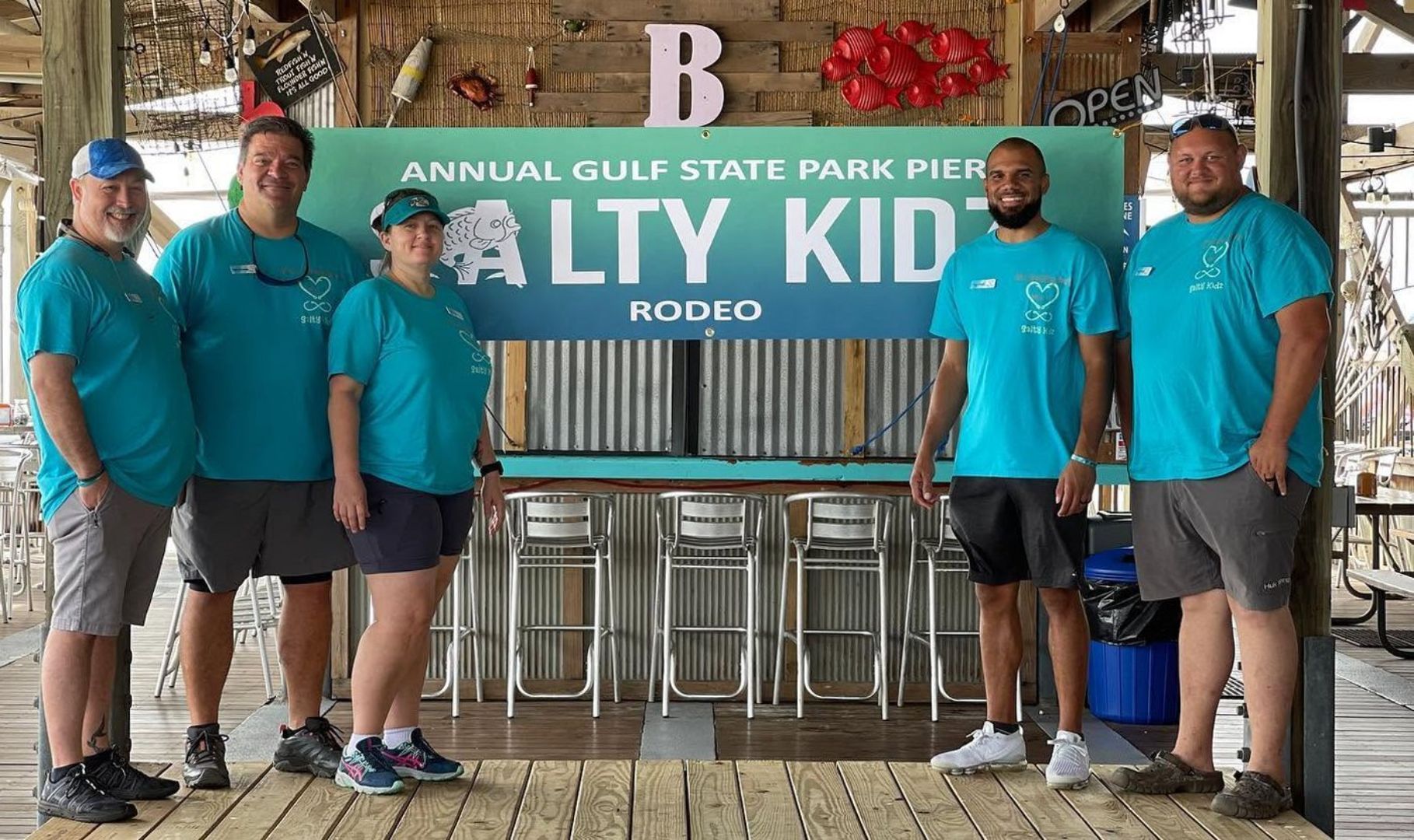
Gulf Shores, Ala. — (OBA) — The Salty Kidz Rodeo is returning to Gulf State Park Pier. Organizers say they cannot wait to welcome families to the Gulf Coast. The annual event has become a beloved tradition for families in the area. This year promises an exciting day of fishing, fun, and lasting memories.

Orange Beach, Ala. — (OBA) — The Gulf of Mexico is an ecosystem defined by its resilience, having endured one of the most significant man-made environmental disasters in history: the Deepwater Horizon oil spill. Beginning on April 20, 2010, this catastrophic event released nearly 4.9 million barrels of oil into the Gul

Foley, Ala. — (OBA) — Registered voters in Baldwin County Voting Precinct 61 are receiving updated voter information cards. The precinct is in the Foley area. The update follows a name change at the precinct’s polling place. County officials said the physical voting site has not changed.

Gulf Shores, Ala. — (OBA) — Gulf Shores will host the 19th annual Brett/Robinson Alabama Coastal Triathlon in September. Organized by Magic Sports USA, the event draws athletes from across the region to compete along the Alabama Gulf Coast. Racers can choose sprint and Olympic distances, as well as relay formats for t
Foley, Ala. — (OBA) — Foley is getting a much larger, more feature-rich public library at a new location on East Orange Avenue. The new facility will offer residents twice the space of the current building and bring a wide range of new services and programs to the community. A grand opening celebration is planned in A
