NOAA Rolls Out Major Hurricane Forecast Upgrades Ahead Of 2026 Season
Inland communities will see watches and warnings on the forecast cone for the first time (see 2nd graphic below)
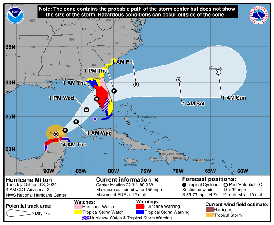
Orange Beach, Ala. — (OBA) — NOAA's National Hurricane Center is implementing major updates to how it communicates storm threats ahead of the 2026 hurricane season. The agency is introducing an improved forecast cone graphic. Officials say these improvements are meant to help more people understand and prepare for dangerous weather. The updates impact both coastal and inland communities.
The updates will take effect at the start of the 2026 hurricane season. They include a redesigned tropical cyclone forecast cone and new storm surge watches and warnings for the Hawaiian Islands. Additionally, a new experimental version of the cone graphic will be introduced this year.
"These improvements empower communities to prepare earlier and more effectively for dangerous hazards from tropical storms and hurricanes," said Michael Brennan, director of NOAA's National Hurricane Center.
One of the most significant changes to the standard forecast cone is the addition of inland watches and warnings. In previous years, the cone graphic mainly focused on coastal areas. Starting in 2026, it will display tropical storm and hurricane watches and warnings for inland regions across the continental United States, Hawaii, Puerto Rico, and the U.S. Virgin Islands.
The change follows a successful experimental phase last year. That trial showed that the updated graphic helped people living away from the coast better understand the dangers posed by tropical cyclone winds. The results gave forecasters confidence to make the change permanent for this season.
The updated cone now uses a uniform shading style for the entire five-day outlook area. A new legend will display symbols indicating locations with both a hurricane watch and a tropical storm warning simultaneously. These areas will be marked with diagonal pink and blue lines on the graphic.
The National Hurricane Center is also introducing a new experimental cone graphic this season. The original cone has been used since 2002 and indicates where a storm's center is most likely to go based on past forecast errors. The new experimental version will alter how that uncertainty is shown.
Instead of using circles at each forecast point, the new experimental cone will use ellipses. This shape allows forecasters to show uncertainty in both the speed and direction of a storm's path. The experimental cone will also cover 90% of possible forecast tracks, compared to the traditional 67% used in the standard cone.
The experimental graphic will be accessible on hurricanes.gov alongside regular and intermediate advisories. However, officials noted that technical issues could occasionally affect whether the graphic is available or posted on time during the experimental phase.
The National Hurricane Center is also expanding its storm surge tools to include Hawaii for the first time. The new products feature storm surge watches and warnings, along with a peak storm surge graphic for the Hawaiian Islands. These tools are already used along the U.S. East Coast, the Gulf Coast, Puerto Rico, and the U.S. Virgin Islands. This expansion means Hawaii residents will now have access to the same storm surge information as communities on the mainland.
Share this article w/ Friends...